
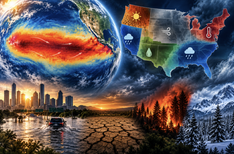
A rapidly strengthening El Niño could become the strongest on record, raising the likelihood of extreme heat, flooding and drought across different parts of the United States as its effects intensify later this year and into 2027.
Climate scientist Daniel Swain said observations already show record-breaking conditions in a key region of the eastern tropical Pacific Ocean, while forecasting models point to considerably more warming in the months ahead.
“This year’s temperatures in this critical El Niño region, represented by this red curve, are now officially exceeding any that we’ve ever seen historically for this region at this time of year,” Swain said during an American Community Media national news briefing.
The event is expected to continue strengthening through the fall, potentially peaking between October and December.
While “Super El Niño” has become a popular way of describing exceptionally powerful events, Swain stressed that it is not an official scientific category.
“There is no formal definition of a super El Niño,” he said.
What scientists are seeing this year, however, goes beyond an ordinary El Niño. Forecast models examined by Swain showed the event exceeding the previous historical record for strength.
“I would suggest maybe we need a new category of extreme El Niño, because the forecast for this year is genuinely extreme,” Swain said.
Why one warm patch of ocean can change weather around the world
At its simplest, El Niño occurs when the eastern tropical Pacific Ocean becomes warmer than average. Those warmer waters alter atmospheric circulation, shifting the paths storms take and influencing weather far beyond the Pacific.
Swain compared the process to dropping a pebble into a pond: the greatest disturbance occurs where it hits, but the ripples spread outward.
Those climate ripples can influence rainfall, drought and temperatures around the world.
El Niño also temporarily releases stored heat from the tropical ocean into the atmosphere. This time, that natural warming is occurring on top of long-term human-caused climate change.
Swain said the combination will likely produce another round of all-time global temperature records over the next six to 12 months, accompanied by an increased likelihood of extreme rainfall, drought and wildfire in different regions.
“It’s like a mini global warming, a temporary one, a natural one,” Swain said. “But it acts on top of the permanent human caused global warming.”
A very different winter depending on where you live
El Niño will not affect every part of the country in the same way.
California could experience a much wetter-than-average winter, particularly in central and southern portions of the state, increasing the potential for inland flooding. Swain also warned of elevated coastal flooding and erosion risks as temporary El Niño-related sea-level rise combines with long-term sea-level rise and unusually high seasonal tides.
In the Southeast, including Florida, Georgia and the Carolinas, Swain said there is high confidence in a wetter-than-average winter, bringing both increased flood risk and the possibility of drought relief.
The Pacific Northwest could face the opposite problem. Washington and surrounding areas may experience worsening drought in places already struggling with dry conditions and wildfires. Hawaii could also see worsening drought this winter.
The Lower Colorado River Basin, meanwhile, may receive average to above-average precipitation, potentially providing some short-term relief to drought-stricken areas of the Southwest. Conditions in the Upper Colorado Basin, including Colorado and Utah, remain less certain.
Even a particularly wet winter would not solve the West’s long-term water crisis.
A strong season could provide “a temporary reprieve,” Swain said, but climate change, long-term aridification and water demand exceeding supply remain much larger problems.
“Nothing that could plausibly happen in the next year could really reverse the broader trajectory,” he said.
More rain doesn’t necessarily mean more snow
A wetter winter also does not necessarily mean a snowier one.
Swain expects above-average precipitation in the Sierra Nevada, but temperatures will determine whether that moisture falls as rain or snow. Higher elevations could receive significant snowfall while lower elevations receive more rain.
“Probably wet, but not necessarily cold, especially if we incorporate global warming,” Swain said.
The health effects may outlast the storms
Some consequences could emerge well after winter ends.
Floods and severe drought can increase the risk of waterborne illness, particularly in communities without reliable water-treatment infrastructure. In the United States, Swain identified some rural and Tribal communities as potentially more vulnerable when extreme weather disrupts access to clean water.
He also highlighted Valley fever, a fungal disease found in parts of the Southwest and northern Mexico.
The fungus grows in wet soil and can become airborne after conditions dry out. A wet El Niño period followed by hot, dry and windy weather could therefore create conditions favorable for its spread.
“There’s a decent chance that we will see an uptick probably next summer and fall,” Swain said.
When will the biggest effects arrive?
The timing is important.
Swain expects El Niño itself to peak sometime between October and December, centered around November, before beginning to weaken during the winter.
But Americans may experience some of its strongest effects after the event reaches peak strength.
“The peak impacts will actually probably not be for for until December through March or even later in some places,” Swain said.
That leaves communities with several months to prepare.
Swain cautioned against interpreting the forecast as a prediction of catastrophe. Extreme consequences are possible in some regions, but precisely where individual storms, floods or other events occur cannot be known months in advance.
What makes the developing El Niño important is that many of the broader risks can already be anticipated, giving governments, communities and individuals time to reduce their vulnerability.
“We can’t prevent El Nino, but we can prepare, hopefully successfully, to mitigate its impacts by putting measures into place to make those impacts less consequential,” Swain said.
That preparation window may prove just as important as the forecast itself.
